Unuvun
Unuvun
Geography
Administration
Demographics
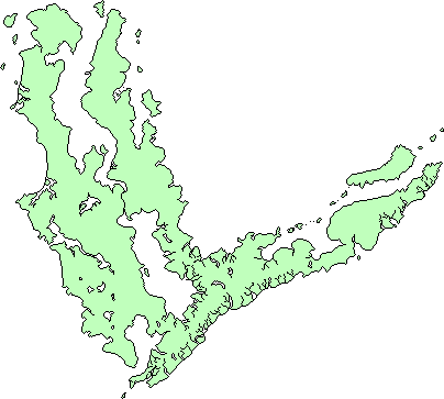
The island of Unuvun is the principal island in the Unuvi Archipelago. Located on the southern rim of Delezia-Hazele, its climate is dominated by the global circumpolar current, which bring torrential amounts of rain to the western plains of the island. It is one of the cultural hearths of Pavala as it was here that the Aeridanish developed.
Etymology
[Derived from 'cornerland' cause they're shaped like a corner and also on the corner of pavala]
Geology
[Southwest is terrane split off from Nohkta-Ivinis, rest is from subduction volcanic arc that got split into two by back arc basin]
[Off coast of Hsuvei plain is a big shelf - both of these regions are NOT karst/limestone but rather have more stable bedrock so i can have my massive subway systems]
Ecology
The island can be mainly divided into three separate sections: The flat southwest, hilly north-central and fjord-carved east. The southwest plains, mainly the Hsuvei Plain, have long been developed into an agricultural heartland. However, forests of indigenous <redwood trees> still remain in the hilly north and central regions, reaching upwards of a hundred meters in height. The vast majority of the trees on the island are evergreen, and there are numerous different species of fruits trees that have been cultivated.
